I launched the kayak of the south coast of Cornwall early this morning and the plan was to drift over a reef that in the past had produced Pollack, Wrasse, and the occasional Cod.
The weather forecast was for force 3 to 4 offshore winds increasing to force 4 to 5 in the afternoon therefore, I knew I might have to come in when the wind started to increase.
On the way out to the reef, the conditions looked good and apart from some fog, rising up over the cliff it was clear and sunny.

In the past, I managed to find this reef using landmarks and lobster pot buoys, which was fine however, I could never be sure where the rough ground started and finished.
About a month ago, I fitted a Garmin Echo 550c fish finder and it was now great to be able to see the structure for myself.

For me, the fish finder's main use is to read the depth of the water and the structure of the seabed however, recent trips have taught me that it can be useful to locate fish holding areas and the following is an example from a previous trip showing suspended shoals of Pollack.

I fished the reef for three hours and never caught anything and there were no fish showing on the sounder. I decided to paddle about a mile to another rough ground mark that in the past had also produced Pollack, Wrasse, and the occasional Cod. I fished this mark for another couple of hours but again no fish caught and no fish on the sounder. This was rapidly looking like it might be a disappointing day!
As per the forecast, the wind started to increase therefore, for safety reasons I decided to move a bit closer to shore and the launch site. I had never paddled this route before therefore, as a matter of interest; I kept the fish finder on. The ground was looking featureless until some rough ground started showing with suspended fish above the rough ground.
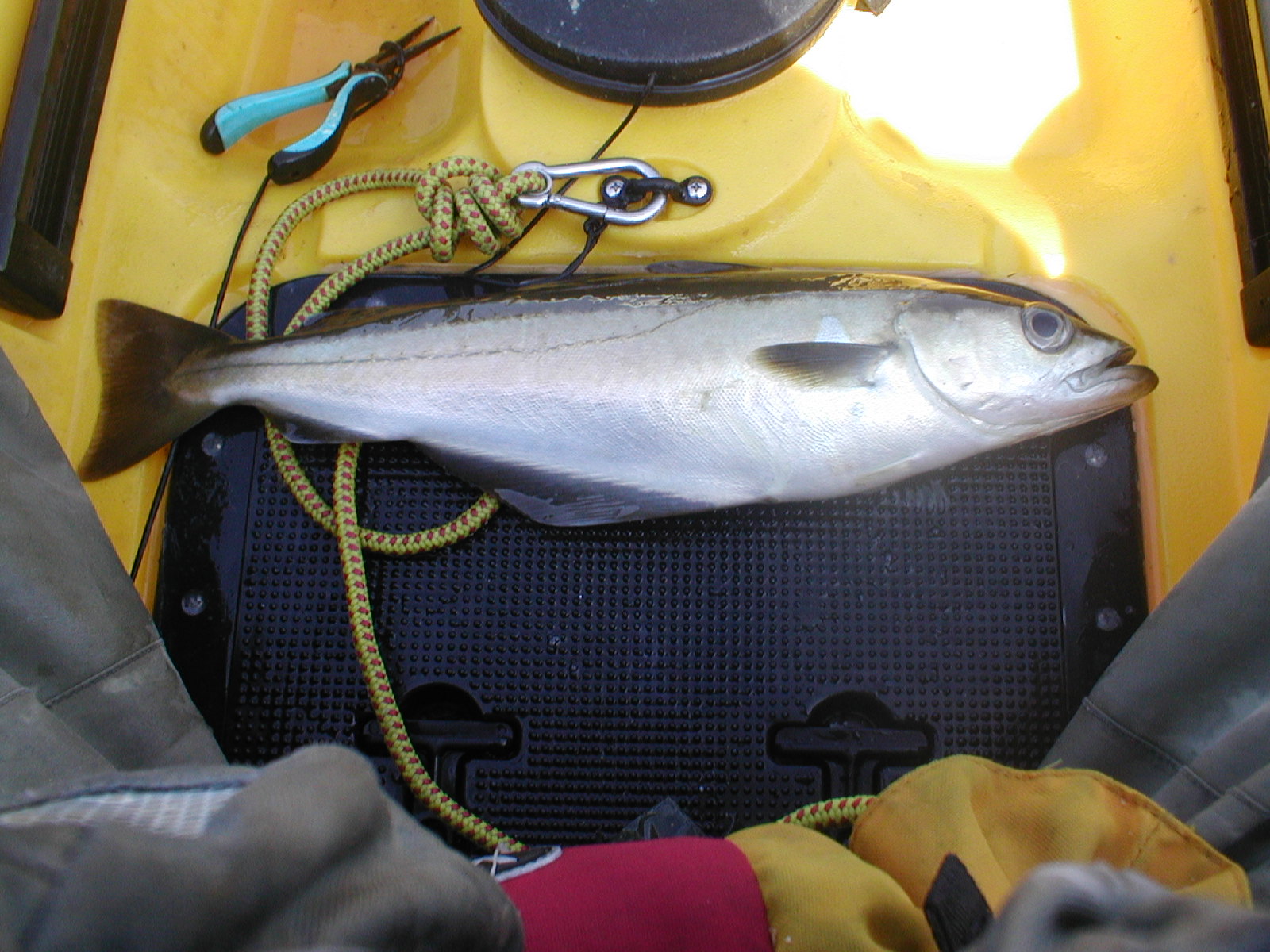
I quickly despatched the drift chute, lowered the Savage Sandeel down amongst the fish, and immediately had a take and up came a Pollack.

When vertical jigging, one thing I like about the Garmin Echo 550c is that set on split frequency (200 kHz - 77 kHz) the 77 kHz will show the jig going down and the jig working. This is a great help when trying to get the lure amongst the fish.
By the time I had dealt with the fish, I had drifted back over featureless ground. I now had to try to find the rough ground and the fish again. This I managed to do and down went the lure once more. Within a few turns of the reel, the rod bent over and another fish was on. Again, it was a Pollack.
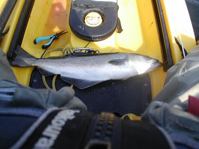
This Pollack was a better-sized fish and took me longer to land and by the time I managed to get the fish on the kayak and remove the hook, I was once again over a featureless seabed.
I spent the next 30 minutes trying to find the rough ground and the fish once more. No matter how many times I tried to judge the direction of the drift, I could not find the mark. Unfortunately, I do not have GPS therefore, could not mark it as a waypoint. I suspect the mark was not that large but at the time, there were a lot of fish showing. A Garmin GPS Map 78 is definitely on the shopping list!
I then decided to stop for the day however, on a positive note, without the fish finder I would have blanked. I simply would not have come across the rough ground and the fish. In the past, I would have just paddled on very unaware of what was below.
The fish caught were definitely a bonus to a difficult day's fishing.

Below are few photo's from the day.


In the past, I managed to find this reef using landmarks and lobster pot buoys, which was fine however, I could never be sure where the rough ground started and finished.
About a month ago, I fitted a Garmin Echo 550c fish finder and it was now great to be able to see the structure for myself.

For me, the fish finder's main use is to read the depth of the water and the structure of the seabed however, recent trips have taught me that it can be useful to locate fish holding areas and the following is an example from a previous trip showing suspended shoals of Pollack.

I fished the reef for three hours and never caught anything and there were no fish showing on the sounder. I decided to paddle about a mile to another rough ground mark that in the past had also produced Pollack, Wrasse, and the occasional Cod. I fished this mark for another couple of hours but again no fish caught and no fish on the sounder. This was rapidly looking like it might be a disappointing day!
As per the forecast, the wind started to increase therefore, for safety reasons I decided to move a bit closer to shore and the launch site. I had never paddled this route before therefore, as a matter of interest; I kept the fish finder on. The ground was looking featureless until some rough ground started showing with suspended fish above the rough ground.
I quickly despatched the drift chute, lowered the Savage Sandeel down amongst the fish, and immediately had a take and up came a Pollack.
When vertical jigging, one thing I like about the Garmin Echo 550c is that set on split frequency (200 kHz - 77 kHz) the 77 kHz will show the jig going down and the jig working. This is a great help when trying to get the lure amongst the fish.
By the time I had dealt with the fish, I had drifted back over featureless ground. I now had to try to find the rough ground and the fish again. This I managed to do and down went the lure once more. Within a few turns of the reel, the rod bent over and another fish was on. Again, it was a Pollack.

I spent the next 30 minutes trying to find the rough ground and the fish once more. No matter how many times I tried to judge the direction of the drift, I could not find the mark. Unfortunately, I do not have GPS therefore, could not mark it as a waypoint. I suspect the mark was not that large but at the time, there were a lot of fish showing. A Garmin GPS Map 78 is definitely on the shopping list!
I then decided to stop for the day however, on a positive note, without the fish finder I would have blanked. I simply would not have come across the rough ground and the fish. In the past, I would have just paddled on very unaware of what was below.
The fish caught were definitely a bonus to a difficult day's fishing.

Below are few photo's from the day.


No comments:
Post a Comment
Note: only a member of this blog may post a comment.